
First Photograph of Earth from Space, 1946
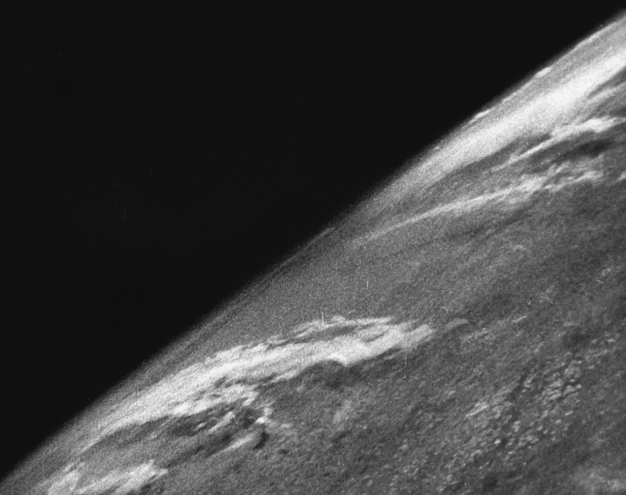
First photo of the Earth from Space. Image Credit: Department of Defense, Department of the Army 1946
When I think about space, I think of Earth. The pinnacle of the space program has been seeing the Earth from space and gaining a perspective of our place in the universe impossible otherwise. By reaching for the heavens, we came to see ourselves. We found home. The first image of Earth from space stands as a crowning achievement of humankind’s quest for understanding, borne, ironically, from humanity’s darkest nature.
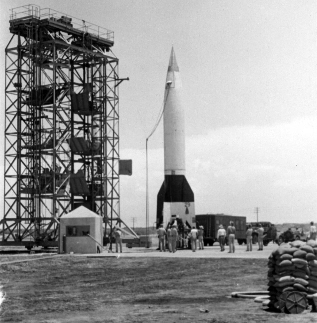
During World War II, Germany developed the V-2 rocket to rain terror and death upon Britain. When the war ended in 1945, the United States captured hundreds of the V-2s and brought them back to the United States and White Sands Proving Ground in New Mexico for testing.
On October 24, 1946, the US Army launched a V-2 that carried a 35mm camera taking photographs every 1.5 seconds as the rocket climbed to a height of 65 miles.
The above image is the first photograph taken of the Earth from space. The V-2, a terrible weapon designed and developed to destroy, transformed into a tool of discovery and destiny.
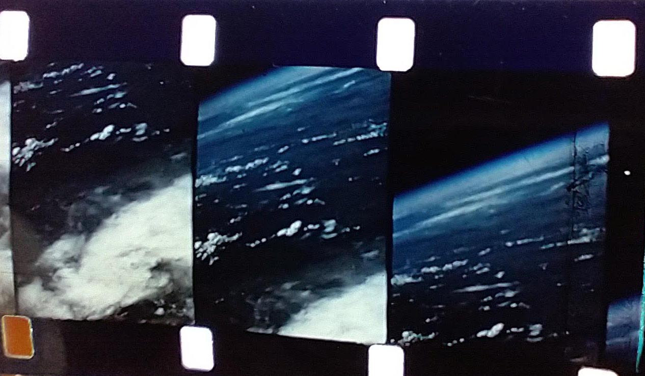
Later V-2 flights took thousands of additional photographs, enabling assembly into panoramas and video, such as those below.
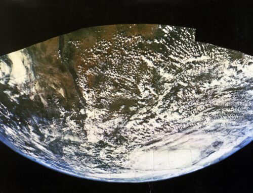
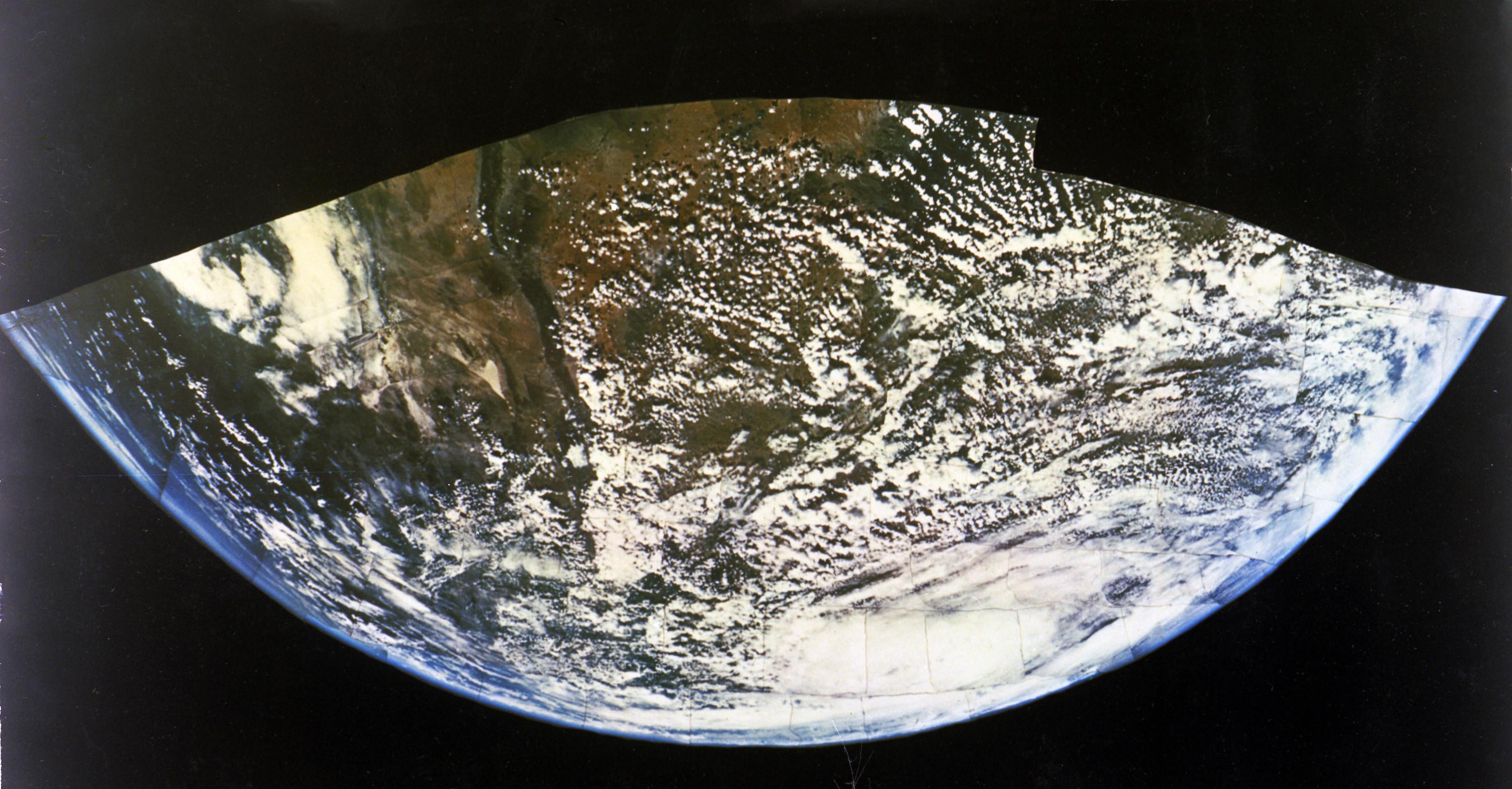
The first panorama is comprised of photos taken from an altitude of 60 miles, with a view expanding from Albuquerque and Santa Fe in New Mexico to the Gulf of California and the Baja Peninsula.
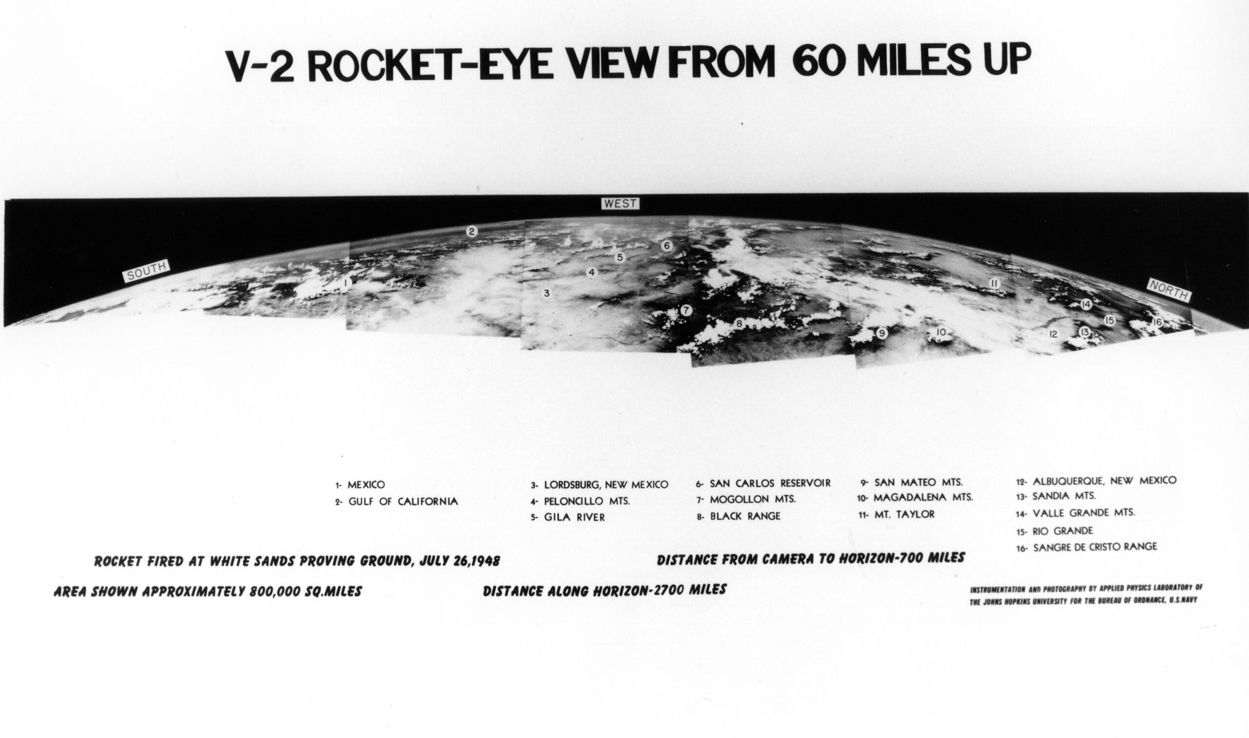
Image Credit: Johns Hopkins Applied Physics Laboratory
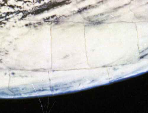
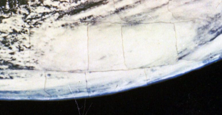
The next panorama was created with photographs taken in 1948 from an altitude of over 100 miles, the highest taken with the V-2.
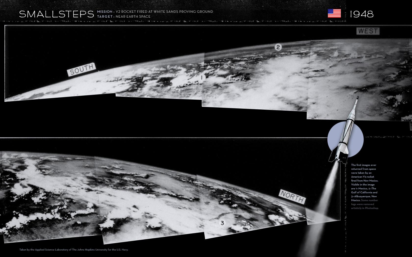
Image Credit: Johns Hopkins Applied Physics Laboratory
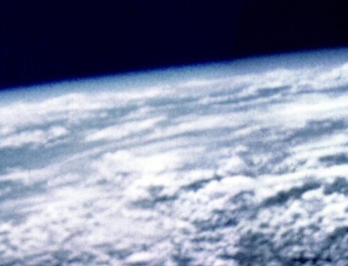
The video below is of a V-2 flight from February 17, 1950, that travelled approximately 90 miles into space. The first 37 seconds show the 35mm camera being attached to the rocket. Film of the launch of the V-2 runs until 1:21. At 1:22 the perspective changes to the camera on the rocket as it rises into space. You can clearly see White Sands, Malpaise Valley of Fires lava flows, and the Sacramento Mountains as the rocket climbs. By 2:21 in you can see the curvature of the Earth and the rocket begins to spin – first along the horizon and then at various angels as the rocket tumbles. There are some nice views of White Sands at 3:22, Elephant Butte and Caballo Lakes at 3:36, the Gulf of California and Baja California Peninsula at 4:01, and Malpaise Valley of Fires lava flows at 4:33. Video Credit: Department of Defense, Department of the Army, 1950.
Note: The video speed can be changed under settings.
Below is a National Geographic Magazine article, “Seeing the Earth from 80 Miles Up,” (pp. 511-528) from October 1950 by Clyde T. Holliday, who appears in the above video loading the camera onto the V-2 rocket, with full details of the flight along with many full page photographs.
